Earthquake mapping Gulf of Aqaba
Earthquake mapping Gulf of Aqaba
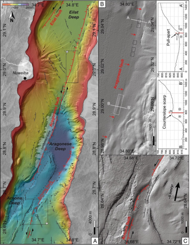
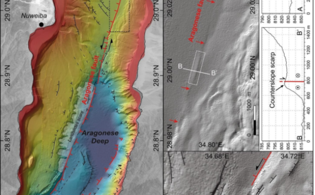
In a multi year mission Professor Sigurjon from the KAUST Department of Geophysics and hydrographic surveyors from CMR successfully mapped the entire Saudi jurisdiction sector of the Gulf of Aqaba. The research vessels RV Thuwal and the Fugro vessel Kobi Reugg were used at different stages. A multisensor survey approach was taken which was comprised of detailed single beam, mulitbeam, sub bottom profiler, towed side scan and ROV surveys of the Gulf of Aqaba.
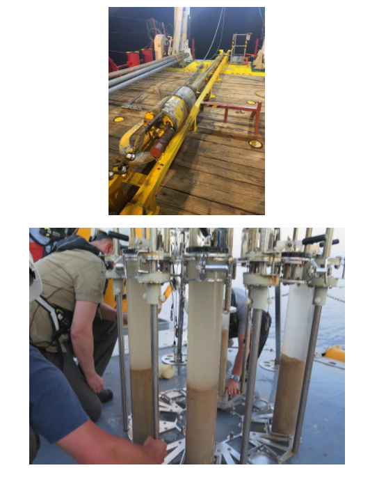
Once mapped targeted sediment sampling took place using a KC Denmark multicorer, a KC Denmark 500kg gravity corer and finally the Fugro 900kg piston corer system.
Initial results were impressive and the first publication by Matthieu Ribot highlights some of these early results.